Indonesia Scenario Assessment for Emergencies (InaSAFE) is free software that produces realistic natural hazard impact scenarios for better planning, preparedness and response activities.
The InaSAFE software had its preliminary launch by Dr Agus Wibowo, the Head of the Indonesian Disaster Management Agency’s Data Centre, at the Understanding Risk Forum in Cape Town on 3 July, 2012 (https://bnpb.go.id/website/asp/berita_list.asp?id=894). There were over 300 downloads of the software within the first three weeks of its preliminary launch.
Concept
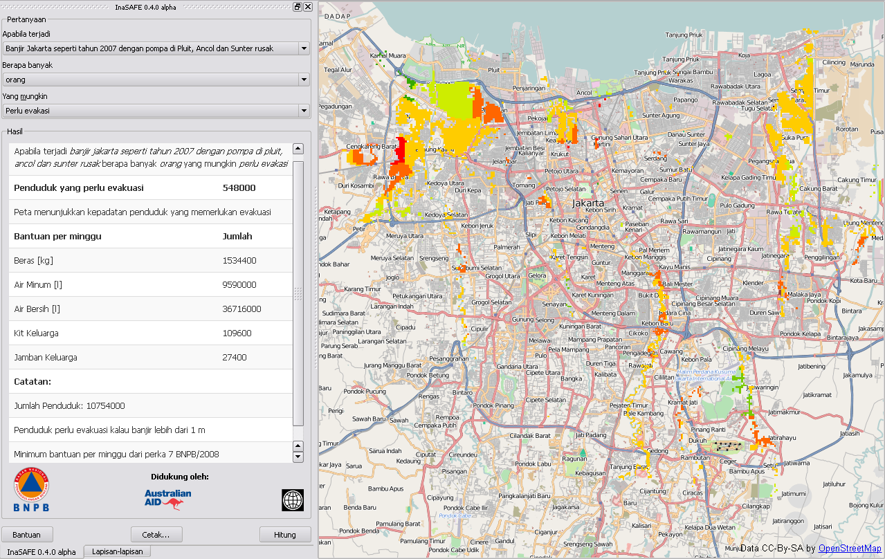
To effectively prepare for future floods, earthquakes or tsunami you must first understand the likely impacts that need to be managed. For example, to prepare contingency plans for a severe flood in Jakarta, emergency managers need to answer questions like:
- what are the areas likely to be affected;
- how many people will need to be evacuated and sheltered;
- which schools will be closed;
- which hospitals can still take patients; and
- what roads will be closed?
How does it work?
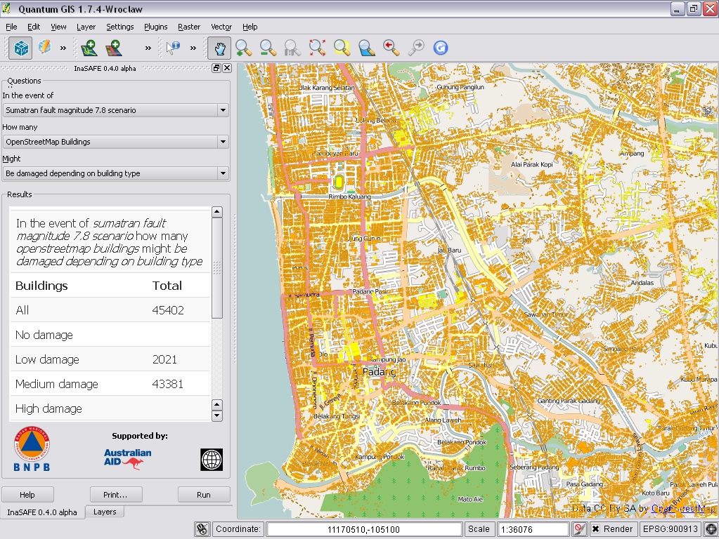
InaSAFE provides a simple but rigorous way to combine data from scientists, local governments and communities to provide insights into the likely impacts of future disaster events. The software is focused on examining, in detail, the impacts of a single hazard would have on specific sectors. e.g. location of primary schools and estimated number of students affected by a possible tsunami in Maumere.
Who can use it?
Anyone with basic computer skills can quickly learn to use InaSAFE to explore the potential impacts of a disaster event and to produce maps and reports of these impacts. The software leads a user through the process of asking specific questions and then estimating the likely damage that a hazard will cause to people and critical infrastructure such as schools, hospitals, roads, etc.
Where does the data come from?
Effectively preparing for a disaster requires people from a wide range of sectors and backgrounds to work together and share their experience, expertise, and resources. Using InaSAFE to develop a scenario requires the same spirit of cooperation and sharing of expertise and data.
InaSAFE is designed to use and combine existing data from science agencies, local governments, and communities. Normally, information on the location of people and important assets are provided by local communities and government departments responsible for each sector, often through a facilitated part of a disaster preparedness and planning exercise.
Where spatial data doesn’t exist, external tools such as OpenStreetMap (www.LearnOSM.org) can allow governments and communities to quickly and easily map assets that are important to them.
It is important to note that InaSAFE is not a hazard modeling tool. Information on hazards needs to be provided either by technical experts, often from Government agencies, universities or technical consultants, or from communities themselves based on their previous experiences.
The more communities, scientists and governments share data and knowledge, the more realistic and useful the InaSAFE scenario will be.
Where do I get more information?
The InaSAFE website (www.inasafe.org) has more information and instructions for installing InaSAFE.
InaSAFE was conceived and initially developed by the Indonesia’s National Disaster Management Agency (BNPB) and Australia through the Australia-Indonesia Facility for Disaster Reduction (AIFDR), the World Bank and the Global Facility for Disaster Reduction and Recovery.
InaSAFE Flier PDF Download (1.8 MB) | Bahasa Indonesia Download